July 30th 2020, 17:00, Nordhavnstippen, Copenhagen. Performative trace (work in progress).
Nordhavnstippen is the outcome of Mapping the City, a site-specific research residency organised by Metropolis. I arrived with one question to Copenhagen: what is the relationship between mapping and inhabiting?
I was looking for spaces in transition, for instance, a plot of land where a new building will be built. To the naked eye, these areas might appear as terrains vagues, obsolete, anonymous. Yet, there is a plan: somebody has made a decision, and something will change.
My intention was to research alternative mapping tools or procedures for urban planners and policymakers. I had in mind a specific stage of the decision-making process, namely the period when you’re making a diagnosis. That too is mapping: you are providing an assessment. Based on that evaluation, a proposal will be drafted, and eventually, a version of it might be implemented. Even when leaving administrative, financial, and political constraints aside, there is always a moment of doubt. What do you, the person who is mapping and coming up with a policy or design, wish to do? What informs the ways you, expert, imagine space?
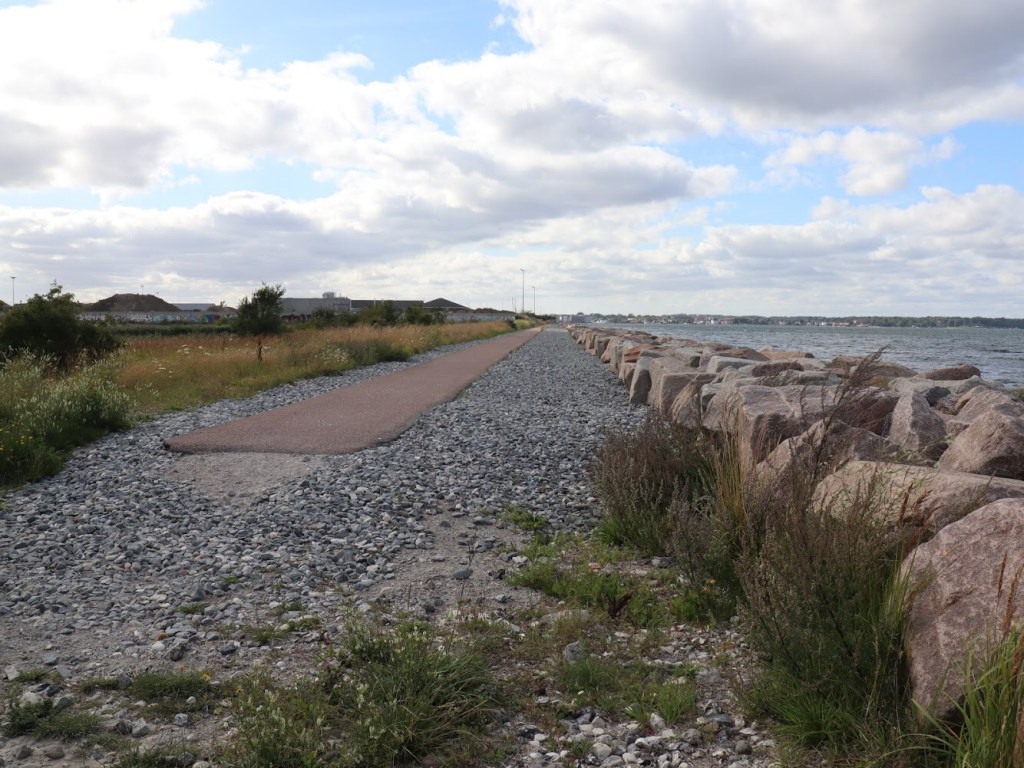
While getting to know the city, I paid attention to its greenery and settled in Nordhavnstippen, by the sea.
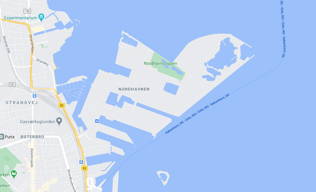
Although increasingly popular, Nordhavnstippen is unknown to most Copenhageners. This informal (wild) and biodiverse green space is located in outer Nordhavn (The North Harbour). A former industrial area, it is currently the largest urban development project in Scandinavia. The 2009 masterplan and its 2018 revision envision changes in outer Nordhavn that would significantly transform Nordhavnstippen, including covering its two lakes to run a metro line. The area has been crucial in debates over nature in Nordhavn, and the municipality is now seeking a new route for the metro to avoid crossing the lakes. However, it’s not clear how much of the landscape will be preserved.
A meeting with an employee from By & Havn, the agency that owns the land, gave me access to Nordhavn’s revised structural plan. I got a better overview of the stakeholders involved, which led me to Nordhavns Naturvenner (Nordhavn’s Nature Friends). It’s an umbrella association gathering ten organisations engaged with nature and urban development in Copenhagen. It exists since 2018, and they have drafted an alternative proposal for Nordhavn. Each proposal conveys a different vision of the future, and they’re both informing it.
Urban diagnostics follow a logic of their own: I ignored what I knew and focused on my artistic practice. And spending time in places non-productively is at the core of my practice. We think of places according to our background and what we know about them. Yet we seldomly trust what is already there; what our body, a singular body, experiences on site. That’s how I understood inhabiting in this context, and what I decided to share with my colleagues (my audience).
Sharing research is sharing what puts you into motion. For me, alternative “tools” for mapping is not about finding something new. It’s an excuse to question interiorised behaviours and imaginaries in city planning. If I wish to create a piece/workshop for planners and policymakers, it’s not to teach, but to face a series of shortcomings. We are prisoners of global trends and frozen images of development. We need to acknowledge our reluctance to engage with space in its multiplicity. There’s much to be unlearned, together. My intentions might sound naïf, but they are rooted in deep frustration and disenchantment.
At this stage of my research, I was not interested in working with local inhabitants. I lacked time for in-depth analysis of the situation in Nordhavnstippen and how it informs broader debates in Copenhagen. I didn’t look for alternative mapping tools because I was busy keeping my focus on sensing the landscape as it was “then”. So, instead of contextualising data (my comfort zone), I prepared two booklets: The Rock and The Pathways.
Each booklet focused on a specific area of Nordhavnstippen. The Rock invited the audience to the waterfront while The Pathways led them to the fields. When asking participants to choose their booklets, I only told them the site’s name, nothing else. Composed of a series of written suggestions, the booklets guided them through space, but they did not voice what they should focus on. The idea was to give them time to pay attention to the landscape and their presence as part of the surroundings. I tried to value listening and observation to avoid falling into the trap of “filling up” space. I now wonder: what happened that day in Nordhavnstippen? And what is taking place at this very moment?
The booklets are not the prototype of a mapping tool, but they allowed me to get closer to the moment when space is still foreign to us, undefined. Written suggestions of this kind can easily fall into the trap of white-collar mindfulness. However, I stand by their potential: let’s be perseverant with our skills.
To learn more about the residency and the booklets, I invite you to watch the video below (includes documentation).
